SAGA - System for Automated Geoscientific Analyses - is a Geographic Information System (GIS) software with immense capabilities for geodata processing and analysis. SAGA is programmed in the object oriented C++ language and supports the implementation of new functions with a very effective Application Programming Interface (API). Functions are organised as modules in framework independent Module Libraries and can be accessed via SAGA’s Graphical User Interface (GUI) or various scripting environments (shell scripts, Python, R, ...).
Please provide the following reference in your work if you are using SAGA:
Conrad, O., Bechtel, B., Bock, M., Dietrich, H., Fischer, E., Gerlitz, L., Wehberg, J., Wichmann, V., and Boehner, J. (2015): System for Automated Geoscientific Analyses (SAGA) v. 2.1.4. Geosci. Model Dev., 8, 1991-2007, https://doi.org/10.5194/gmd-8-1991-2015.
For more information visit the project homepage and the wiki.
Features
- Object oriented system design (C++)
- Modular structure allows framework independent function development
- SAGA API with immense support for geodata handling
- GUI for intuitive data management, analysis and visualization
- Runs on Linux as well as on Windows operating systems
- Portable software running without installation even from memory sticks (MSW)
- Free and Open Source Software (FOSS)
- Scripting via command line, Python, Java, R
- Far more than 450 freely available functions for geodata analysis
- Georeferencing and cartographic projections
- Grid interpolation of scattered point data, triangulation, IDW, splines, ...
- Vector tools: clipping, buffer zones, raster to vector conversion, ...
- Image analysis: filters, supervised classification, PCA, FFT, OBIA, ...
- Geostatistics: GWR, variograms, ordinary & universal Kriging, ...
- Terrain analysis: morphometry, hydrology, illumination, classification, ...
- and many more ...
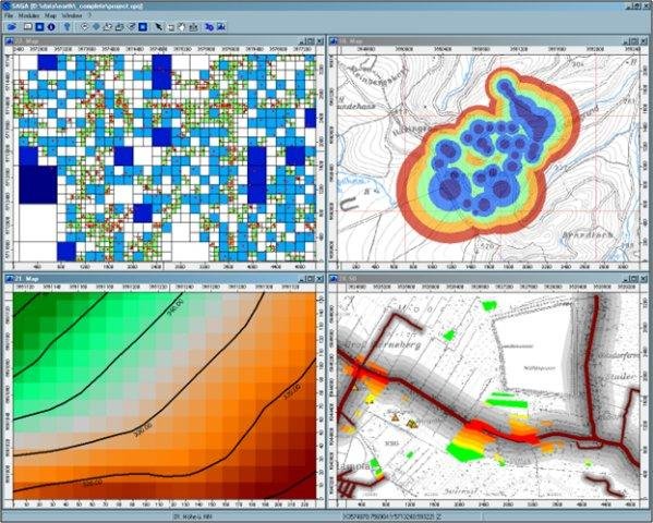
Project Samples


License
GNU Library or Lesser General Public License version 2.0 (LGPLv2), GNU General Public License version 2.0 (GPLv2)Follow SAGA GIS
User Reviews
-
very good for student
-
I like the software is versatile and easy to follow, but, is poor on tutorials for learning it.
-
I have been working with SAGA for a while. It is powerful, straightforward, and fast. I also created a couple of custom modules and, while there are some problems, it was doable. While using the GUI is easy, dealing with the API is not as smooth: there are no good tutorials to get started (the one in the "A Gentle Introduction to SAGA GIS" misses some important aspects and is a bit outdated). I was working with version 2.1.2, but the documentation available was for a different incompatible version, and I didn't get any help at the forum. Also, sorting out which libraries and compilers are ok with which version of the GUI can be a pain, and it is hard to find out why a custom library does not load at a given point. I also wish that you could easily work with a free IDE like Qt or Eclipse; instead, you have to develop your modules on Visual Studio. I also wish that the documentation in the modules was better: you cannot know what a module or some of their parameters do many times. All this said, I really appreciate SAGA GIS and I wanted really hard to develop my project as a series of modules on this platform. However, it seems that the availability of temporal 2D/3D data management in GRASS GIS will make us move towards that other package. If only they included this data type in the core...