
Menu
▾
▴
Re: [Matplotlib-users] map projections
|
From: John H. <jdh...@ac...> - 2004-07-13 13:29:44
|
>>>>> "Jeff" == Jeff Whitaker <js...@fa...> writes:

    Jeff> Hi:

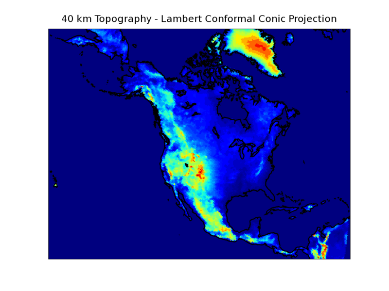
    Jeff> I've hacked together some scripts that let me plot data on
    Jeff> top of world maps with different map projections in
    Jeff> matplotlib.  It's quite slow, but it works!  There's an
    Jeff> example at
    Jeff> http://www.cdc.noaa.gov/people/jeffrey.s.whitaker/plotmap.py
    Jeff> (the plot should look like
    Jeff> http://www.cdc.noaa.gov/people/jeffrey.s.whitaker/plotmap.png).
    Jeff> To run the example you'll need the data files
    Jeff> http://www.cdc.noaa.gov/people/jeffrey.s.whitaker/wcl.txt
    Jeff> (world coastlines) and
    Jeff> http://www.cdc.noaa.gov/people/jeffrey.s.whitaker/topodata.pickle
    Jeff> (data to plot), as well as a module I wrote to compute
    Jeff> cartographic transformations using proj4
    Jeff> http://www.cdc.noaa.gov/people/jeffrey.s.whitaker/python/proj.py.


    Jeff> If anyone knows of a faster way to do this, I'd love to hear
    Jeff> about it.

I am having trouble running this - proj.py is making the system call
'stdin,stdout=os.popen2(cmd,mode='b')' where cmd is

 proj +R=63712000 +lon_0=-107 +proj=lcc +lat_1=50 +lat_2=50 -b

but I don't have proj on my system.  Am I missing something?  Is this
a tool I can easily install?

Also, while I have your ear, what version of matplotlib are you
working with and what backend do you typically use?

Nice map, by the way!

JDH
|
.)

