Menu
▾
▴
Re: [Matplotlib-users] cool screenshot
|
From: Ted D. <ted...@jp...> - 2005-05-13 23:27:46
|
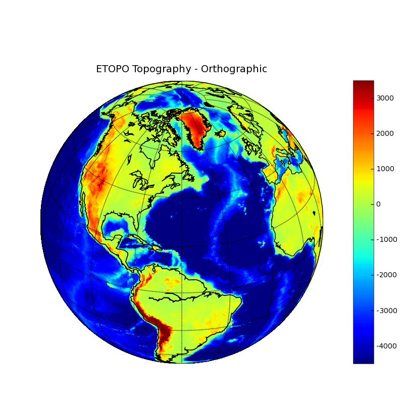
Very cool! At some point in the future we'll be interested in modifying/extending the basemap module to allow other data sets. In particular, we're going to need to do maps of Mars using the Mars laser altimeter database (MOLA). http://pds-geosciences.wustl.edu/missions/mgs/megdr.html I wonder if the ability use GIS data sets could be worked in at the same time using some type of common architecture? Ted At 12:34 PM 5/13/2005, Sean Gillies wrote: >On May 13, 2005, at 1:26 PM, Jeff Whitaker wrote: > >> >>I just added the orthographic projection to the basemap toolkit - you can >>now make really nifty pseudo-satellite views of global data. >> >>Here's an example: >> >>http://www.cdc.noaa.gov/people/jeffrey.s.whitaker/ortho.png >> >>This was generated using pcolor by the plotmap_ortho.py example script >>now in CVS. It requires the pcolor masked-array patch I sent to the >>matplotlib-devel list this morning. For some reason, pylab.contour goes >>berserk when you try to contour data on this projection - I;m still >>working on that. >> >>-Jeff > >Jeff, > >That is slick! You're using PROJ4, right? I'm happy to see a working >application of orthographic projection. We need to talk sometime about >how to hook pylab up to GIS data through GDAL/OGR or to web services using >WMS/WFS. > >cheers, >Sean > >-- >Sean Gillies >sgillies at frii dot com >http://zcologia.com > > > >------------------------------------------------------- >This SF.Net email is sponsored by Oracle Space Sweepstakes >Want to be the first software developer in space? >Enter now for the Oracle Space Sweepstakes! >http://ads.osdn.com/?ad_id=7393&alloc_id=16281&op=click >_______________________________________________ >Matplotlib-users mailing list >Mat...@li... >https://lists.sourceforge.net/lists/listinfo/matplotlib-users |