Related Products
|
||||||
About
GeoPandas is an open-source project to make working with geospatial data in python easier. GeoPandas extends the datatypes used by pandas to allow spatial operations on geometric types. Geometric operations are performed by shapely. Geopandas further depends on fiona for file access and matplotlib for plotting. The goal of GeoPandas is to make working with geospatial data in python easier. It combines the capabilities of pandas and shapely, providing geospatial operations in pandas and a high-level interface to multiple geometries to shapely. GeoPandas enables you to easily do operations in python that would otherwise require a spatial database such as PostGIS. GeoPandas is a community-led project written, used and supported by a wide range of people from all around of world of a large variety of backgrounds. GeoPandas will always be 100% open source software, free for all to use and released under the liberal terms of the BSD-3-Clause license.
|
About
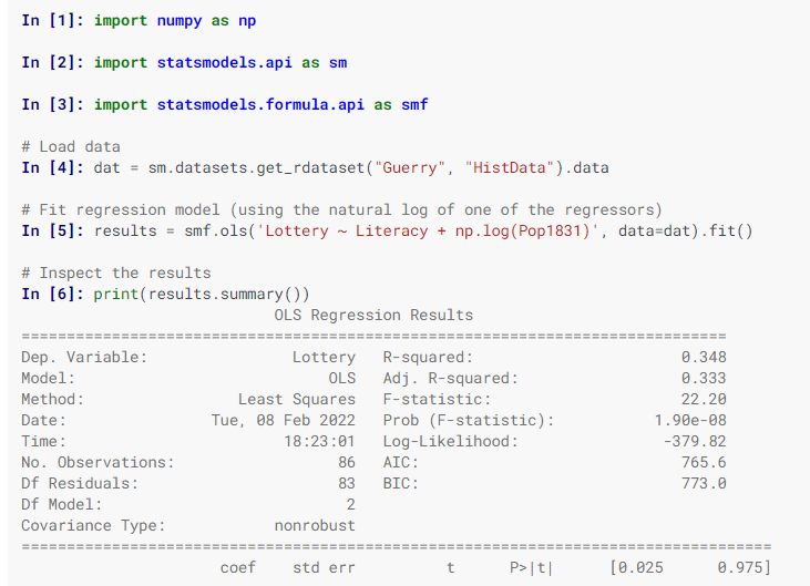
statsmodels is a Python module that provides classes and functions for the estimation of many different statistical models, as well as for conducting statistical tests and statistical data exploration. An extensive list of result statistics is available for each estimator. The results are tested against existing statistical packages to ensure that they are correct. The package is released under the open-source Modified BSD (3-clause) license. statsmodels supports specifying models using R-style formulas and pandas DataFrames. Have a look at dir(results) to see available results. Attributes are described in results.__doc__ and results methods have their own docstrings. You can also use numpy arrays instead of formulas. The easiest way to install statsmodels is to install it as part of the Anaconda distribution, a cross-platform distribution for data analysis and scientific computing. This is the recommended installation method for most users.
|
|||||
Platforms Supported
Windows
Not Supported
Mac
Not Supported
Linux
Not Supported
Cloud
Supported
On-Premises
Not Supported
iPhone
Not Supported
iPad
Not Supported
Android
Not Supported
Chromebook
Not Supported
|
Platforms Supported
Windows
Supported
Mac
Supported
Linux
Supported
Cloud
Not Supported
On-Premises
Not Supported
iPhone
Not Supported
iPad
Not Supported
Android
Not Supported
Chromebook
Not Supported
|
|||||
Audience
Developers and enterprises seeking an open source solution to work with geospatial data in Python
|
Audience
Users and anyone in search of a solution to calculate the estimation of many different statistical models
|
|||||
Support
Phone Support
Not Supported
24/7 Live Support
Not Supported
Online
Supported
|
Support
Phone Support
Not Supported
24/7 Live Support
Not Supported
Online
Supported
|
|||||
API
Offers API
Not Supported
|
API
Offers API
Supported
|
|||||
Screenshots and Videos |
Screenshots and Videos |
|||||
Pricing
No information available.
Free Version
Supported
Free Trial
Not Supported
|
Pricing
Free
Free Version
Supported
Free Trial
Not Supported
|
|||||
Reviews/
|
Reviews/
|
|||||
Training
Documentation
Supported
Webinars
Not Supported
Live Online
Not Supported
In Person
Not Supported
|
Training
Documentation
Supported
Webinars
Not Supported
Live Online
Not Supported
In Person
Not Supported
|
|||||
Company InformationGeoPandas
Founded: 2013
geopandas.org/en/stable/
|
Company Informationstatsmodels
www.statsmodels.org/stable/index.html
|
|||||
Alternatives |
Alternatives |
|||||
|
|
||||||
|
|
||||||
Categories |
Categories |
|||||
Integrations
Anaconda
Not Supported
Google Earth Engine
Supported
Python
Not Supported
Union Pandera
Supported
|
Integrations
Anaconda
Supported
Google Earth Engine
Not Supported
Python
Supported
Union Pandera
Not Supported
|
|||||
|
|
|