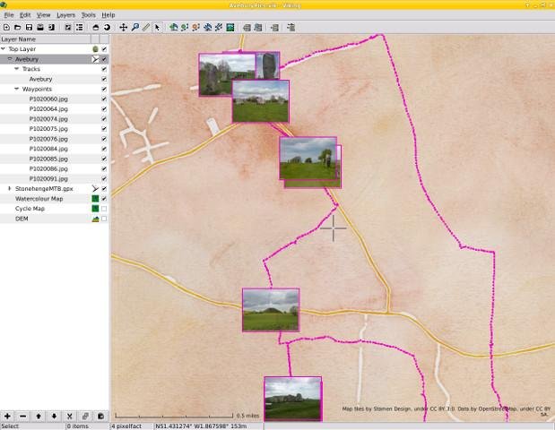
Viking is a free/open source program to manage GPS data. You can import, plot and create tracks, routes and waypoints, show OSM, Bing Aerial and other maps, geotag images, create routes using OSRM, see real-time GPS position (not in Windows), make maps using Mapnik (not in Windows), control items, etc.
It is written in mostly in C (with some C++) & the GTK+3 toolkit.
Viking is currently dual managed - with a corresponding Github presence at:
https://github.com/viking-gps/viking
Where you may find it easier to view the code and raise issues there too.
Features
- GPS
- GPX
- OpenStreetMap (OSM)
- Geotagging
- KML
- Mapnik Rendering
- TCX
- OSRM
Project Samples


License
GNU General Public License version 2.0 (GPLv2)Follow Viking GPS data editor and analyzer
Other Useful Business Software
Ship Agents Faster
Gemini Enterprise Agent Platform lets you rapidly build, scale, govern and optimize production-ready agents grounded in your organization's data. The platform enables developers to build custom or pre-built agents for virtually any use case. New customers get $300 in free credits.
Rate This Project
Login To Rate This Project
User Reviews
Be the first to post a review of Viking GPS data editor and analyzer!
