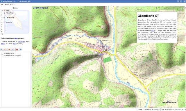
QLandkarte GT is the ultimate outdoor aficionado's tool. It supports GPS maps in GeoTiff format as well as Garmin's img vector map format. Additional it is the PC side front end to QLandkarte M, a moving map application for mobile devices.

Project Samples

Project Activity

See All Activity >

Categories

GIS

License

GNU General Public License version 3.0 (GPLv3)

Follow QLandkarte GT

QLandkarte GT Web Site

You Might Also Like
Eptura Workplace Software Icon
Eptura Workplace Software

From desk booking and visitor management, to space planning and office utilization data, Eptura Workplace helps your entire organization work smarter.

With the world of work changed forever, it’s essential to manage your workplace and assets together to effectively create a high-performing environment. The Eptura experience combines the power of workplace management software with asset management, enabling you to effectively operate your building and facilitate hybrid work.
Rate This Project
Login To Rate This Project

User Ratings

★★★★★
★★★★
★★★
★★
17
0
0
0
1
ease 1 of 5 2 of 5 3 of 5 4 of 5 5 of 5 5 / 5
features 1 of 5 2 of 5 3 of 5 4 of 5 5 of 5 5 / 5
design 1 of 5 2 of 5 3 of 5 4 of 5 5 of 5 4 / 5
support 1 of 5 2 of 5 3 of 5 4 of 5 5 of 5 5 / 5

User Reviews

Be the first to post a review of QLandkarte GT!

Additional Project Details

Operating Systems

Linux, Mac, Windows

Languages

French, Dutch, Italian, English, German, Spanish, Russian

Intended Audience

Developers, End Users/Desktop

User Interface

X Window System (X11), Win32 (MS Windows), Carbon (Mac OS X)

Programming Language

C++

Related Categories

C++ GIS Software

Registered

2007-12-10