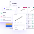
Modular, touch screen friendly navigation system with GPS tracking, realtime routing engine and support for various vector map formats. Works on a wide range of devices, from computers to smartphones.
License
GNU General Public License version 2.0 (GPLv2)

Paccurate is the only patented cartonization solution that optimizes for transportation costs directly. So you can have the right boxes, and control how they're packed.
User Ratings
ease
1 of 5
2 of 5
3 of 5
4 of 5
5 of 5
3 / 5
features
1 of 5
2 of 5
3 of 5
4 of 5
5 of 5
4 / 5
design
1 of 5
2 of 5
3 of 5
4 of 5
5 of 5
3 / 5
support
1 of 5
2 of 5
3 of 5
4 of 5
5 of 5
4 / 5
There are no 2 star reviews.
Additional Project Details
Languages
Croatian, Thai, Tamil, Romanian, French, Ukrainian, Dutch, Polish, Lithuanian, Slovene, Macedonian, Latvian, Czech, Afrikaans, Finnish, Italian, Hebrew, Esperanto, Catalan, Greek, Vietnamese, English, Portuguese, Serbian, Slovak, Chinese (Traditional), Estonian, Galician, Bulgarian, Swedish, Telugu, Turkish, Urdu, Indonesian, Javanese, Norwegian, Brazilian Portuguese, Chinese (Simplified), Danish, German, Japanese, Spanish, Russian, Arabic, Hungarian, Basque (Euskara)
Intended Audience
Advanced End Users, Developers, End Users/Desktop
User Interface
Handheld/Mobile/PDA, Project is a user interface (UI) system, Qt, GTK+, SDL
Programming Language
C++, C
Database Environment
XML-based, Flat-file, Proprietary file format


