A platform independent program to geotag images(use GPS data to store location information with the image).Uses external maps to fine-tune locations.
License
BSD License, Public Domain, GNU General Public License version 2.0 (GPLv2)

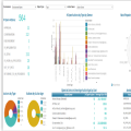
Map, analyze and automate processes, manage regulatory compliance, assess risks within a single platform! Interfacing’s digital twin solution is an enterprise management system that helps companies digitilize processes to streamline operations, increase productivity and continuously improve.
User Ratings
ease
1 of 5
2 of 5
3 of 5
4 of 5
5 of 5
4 / 5
features
1 of 5
2 of 5
3 of 5
4 of 5
5 of 5
4 / 5
design
1 of 5
2 of 5
3 of 5
4 of 5
5 of 5
4 / 5
support
1 of 5
2 of 5
3 of 5
4 of 5
5 of 5
4 / 5
There are no 4 star reviews.
Additional Project Details
Languages
French, Dutch, Czech, English, Brazilian Portuguese, Danish, German
Intended Audience
End Users/Desktop
