Menu

Map Navigator

Giuseppe Aruta

back to [Home] page


Map Navigator

Map Navigator is a geographic data viewer and editor, equipped with tools for measurement, exploration, and routing. The software is written in Java and requires JAVA 8 or later to be installed on the PC.
The goal of Map Navigator is to bridge the functionality between Google Earth and established GIS applications such as ArcGIS, QGIS, and OpenJUMP.
It is engineered to be used as both didactic software and a professional-grade tool.

List of Functions

  • Explore popular world tile servers like OpenStreetMap, OpenTopoMap, Bing Map, ArcGIS World Imagery, among others, and navigate using zoom-to-area, zoom-to-coordinate, and pan tools.
  • Zoom to an address using the OpenStreetMap Nominatim service.
  • Save and recover views in different times of using software witha dedicated set of tools
  • Save views as georeferenced (GeoTIFF, JPG, PNG, GIF, KMZ) and non-georeferenced (SVG, PDF) image files.
  • Print the current view.
  • Geocode points using the OpenStreetMap Nominatim service.
  • Measure polyline length, area, angle, angleby goniometer and azimuth directly in the view, using defined algorithms (Vincenty's algorithm, for lengths, and Shoelace algorithm, for areas, angles algorithms convert geographic coordinates to projected ones)
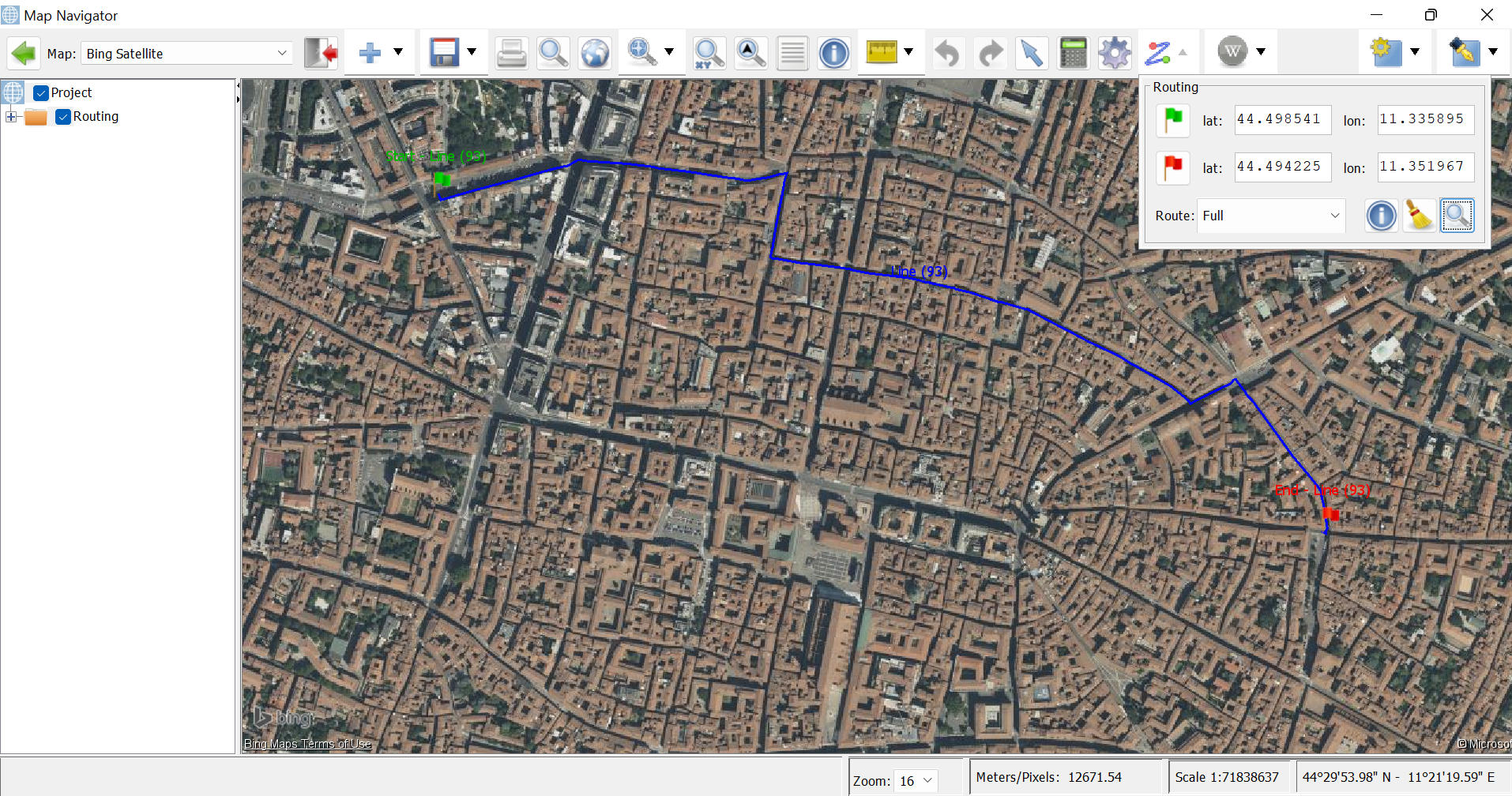
  • Calculate routes between two user-defined coordinates using the Open Source Routing Machine service (currently supports only car routes).
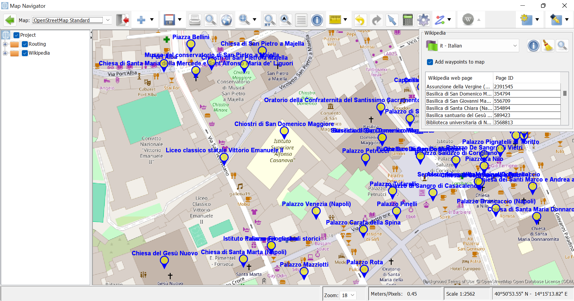
  • Use MediaWiki to find Wikipedia articles near specific coordinates. Due to API restrictions, the search radius is limited to 10 km from the view's center, with a maximum of 50 results per search.
  • Load vector files (such as Google Earth KML/KMZ, GPS GPX, AutoCAD DXF, SHP and geographic CSV) into the view as vector elements.
  • Load raster files (including popular image formats like JPG, PNG, BMP, GIF, TIFF, and KMZ image overlays into the view as raster elements.
  • Draw geographic elements like points, lines, and polygons with user-defined styles and transparency.
  • Add basic Google Earth metadata (name and description) to geographic elements.
  • Point styles according OpenStreetMap and Geological CARG symbology.
  • Use multiple edit tools to edit and convert geometries, extract centroids, extract segments, convert lines to polygons, create holes/islands, and cut lines or polygons, draw adicant polygons, etc.
  • Extract topographic profiles from a polyline using EU-DEM (for Europe) and ETOPO1 (for the rest of the world, including seafloor).
  • Save vectors as Google Earth KMZ , GPX, DXF and geographic CSV data.
  • Save raster to Google Earth KMZ files
  • Translated into French, German, Italian, Portuguese, Spanish and, experimantally, in Arabic, Chinese and Russian languages

Licences

Map Navigator is distributed under GNU GENERAL PUBLIC LICENSE Version 2.

Download

Go to the Download Map Navigator page and download the latest .jar file.

Excute Map Navigator

Map Navigator is written in Java and requires JAVA 8 or later to be installed on the PC.

Once you downloaded Map Navigator unique file, eg. MapNavigator_2025_10_17.jar, there are two ways to execute the program

A.
double click on MapNavigator2025_10_17.jar file

B.

1. create a text file, eg. *mapnavigator.bat*, in Windows or *mapnavigator.sh*, in Linux
2. write java *-jar   MapNavigator_2025_10_17.jar*  into your text file.
3. make the text file executable (see specifications for the operating system in use)
3. double click on your text file.

Map Navigator is available in the following languages: English, French Italian, Portuguese, Spanish and German

Declaimer and Limitation and Liability

This software is provided "AS IS" without any warranties, express or implied, including but not limited to warranties of fitness for a
particular purpose, compatibility, accuracy, reliability, or availability. The licensor does not guarantee that the software, its calculations, or exported data are error-free, secure, or uninterrupted, nor that defects will be corrected.
The merchantability of the software or parts of the software is defined by the GNU GENERAL PUBLIC LICENSE Version 2.
You are solely responsible for verifying that the software meets your needs and for any costs arising from errors, defects, or interruptions. The licensor assumes no responsibility for loss of data, profits, or any other damages, direct or indirect, resulting from use or inability to use the software, even if advised of the possibility of such damages. Use of the software is entirely at your own risk. It must not be used for mission-critical or real-time applications, and all outputs must be
independently checked by qualified experts before implementation.
Nothing in this disclaimer limits liability for death or personal injury caused by negligence or for fraudulent misrepresentation. The limitations
apply to the fullest extent permitted by law.

Author and Contacts

Giuseppe Aruta (giuseppe_aruta@yahoo.it - https://sourceforge.net/projects/opensit/)

Screenshots

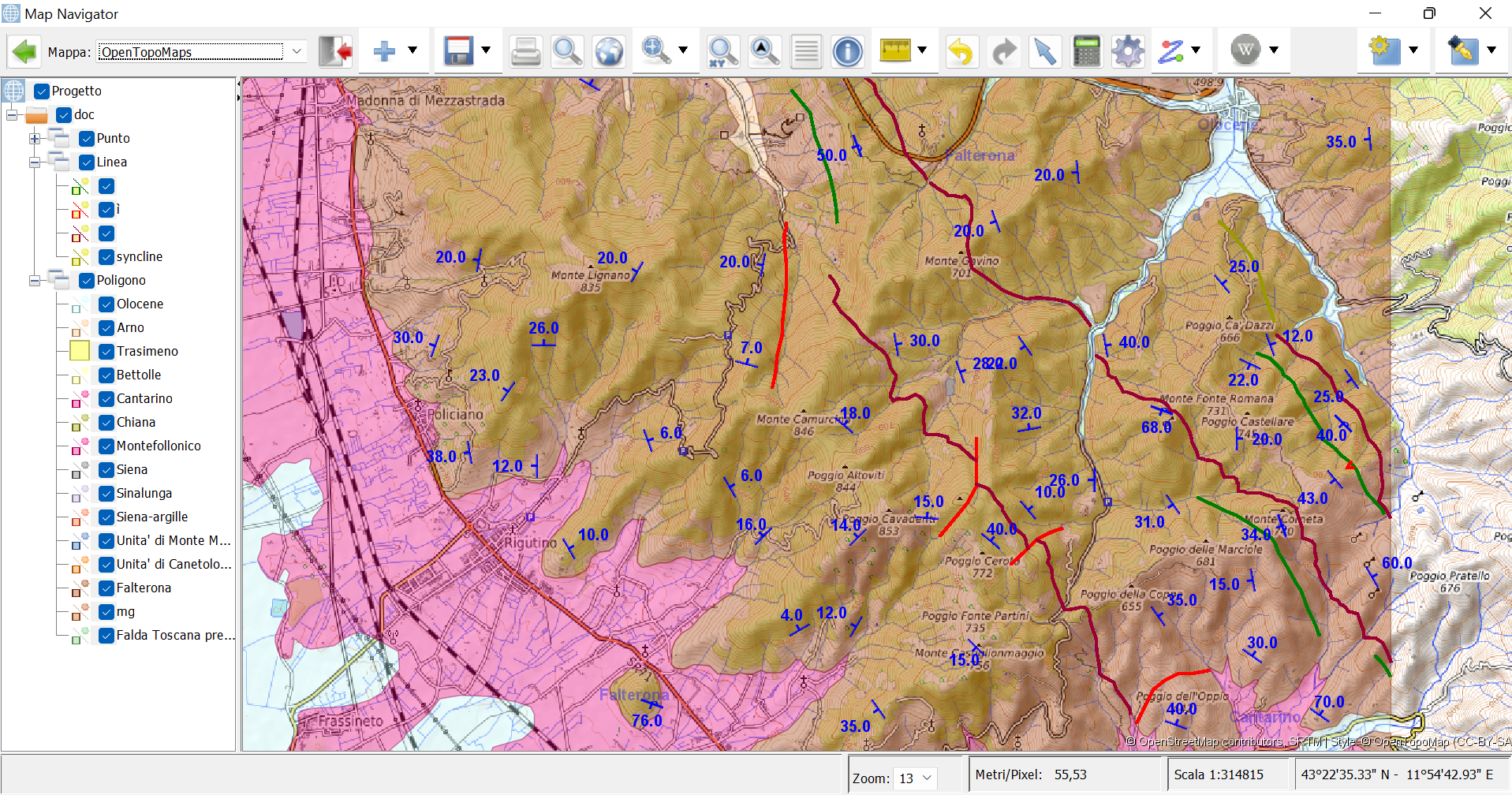
  • Screensot 1: Map Navigator showing an area of Val Di Chiana Map (Tuscany, Italy, author: Giuseppe Aruta) with OpenTopoMap as base map
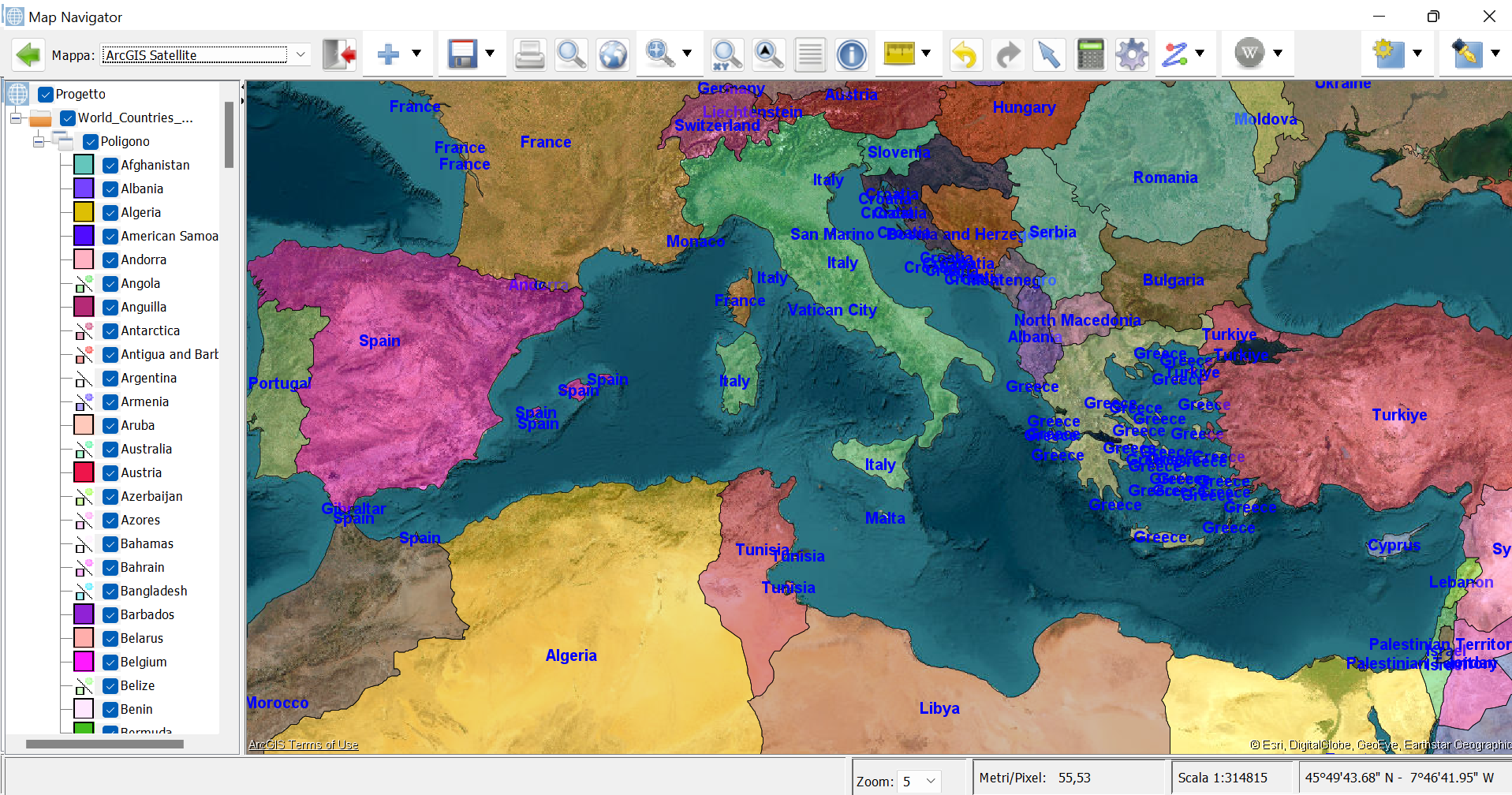
  • Screensot 2: Map Navigator showing the Mediterranean area with seabeds from ArcGIS Satellite as base map
  • Screensot 3: Routing service with Bing Satellite as base map
  • Screensot 4: Wikipedia Geosearch with OSM base map
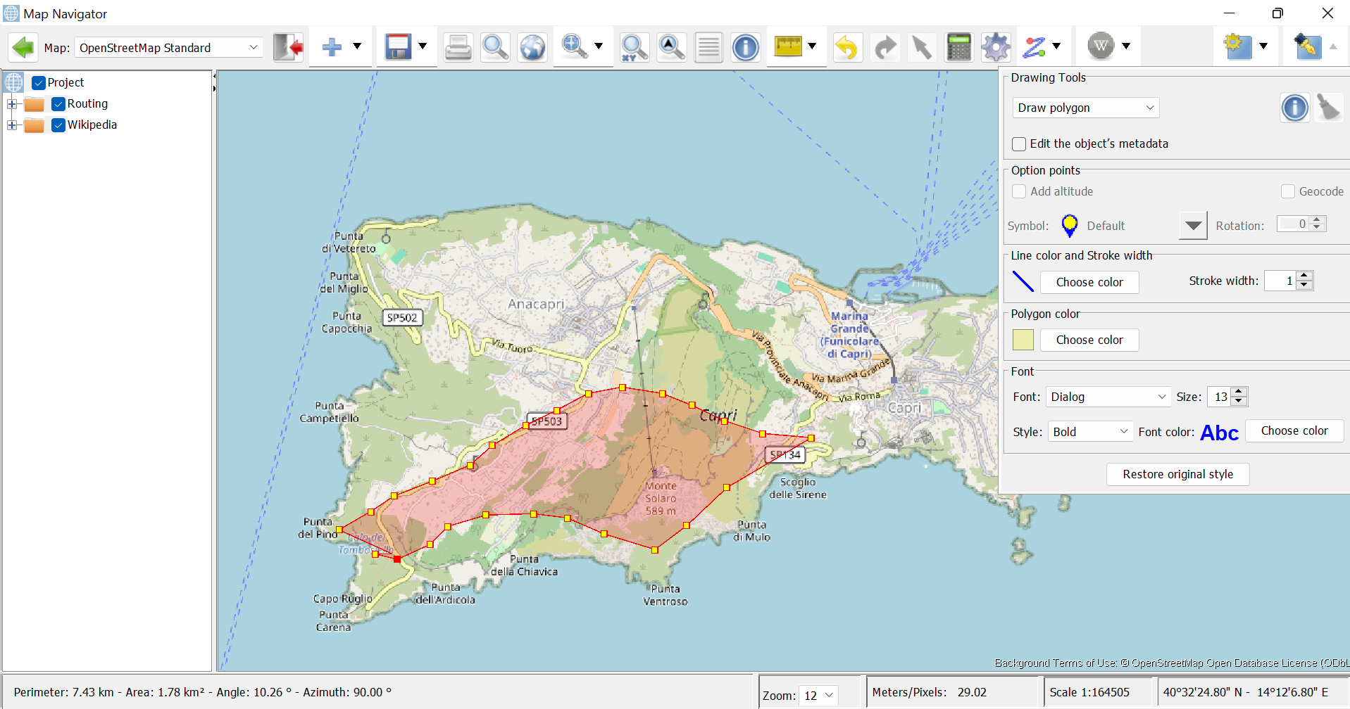
  • Screensot 5: Drawing a polygon on the island of Capri (Italy) , with OSM base map
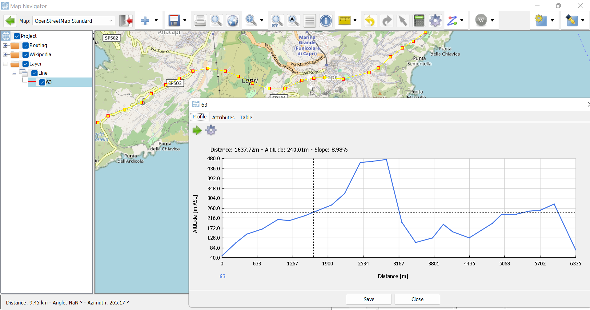
  • Screensot 6: Extracting topographic from a line that crosses the island of Capr (Italy) , with OSM as base map.
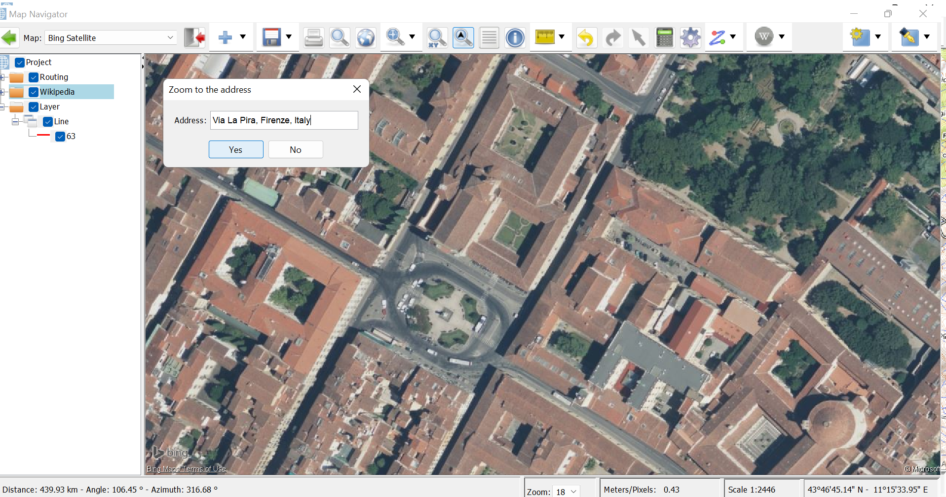
  • Screensot 7: Zoom toan address in Florence (Italy) with Bing Satellite as base map

Information on Java

What is a Geographic information system (GIS)

Google Maps: Coordinates, Tile Bounds and Projection

Web map - Slippy map


Related

Wiki: Home